
Our friends were interested in crystals and geodes, and the rangers are always very helpful in knowing the areas they should be found. Such things are not usually shown on most maps.
 |
| The Tonto National Forest map showing our route. |
 |
| The Tonto Village restaurant, bar and shopping complex. |
We continued on into the forest, and eventually the paved road ended. However, the bridges and other structures within the park were all top notch and in excellent condition. We passed many areas with pull-offs and turn-outs that can be used for primitive camping, and many were in use. The only problem for anyone with larger or low-profile rigs would be the burms and drainage canals at the edge of the roads created by the road graders. Our motorhome would not clear most of them as it sets lower than many other RVs. But for those with the right equipment, these make great options for camping where you can get away from "organized" campgrounds.
 |
| Part of Diamond Point Road with the Mogollon Rim in the background. |
 |
| Wheel ruts on Diamond Point Road. |
 |
| Painting rocks in public lands is just plain vandalism! |
 |
| The best, clearest, and largest of a half-dozen crystals we found. |
 |
| The fire tower and antennas on top of the hill at the end of Diamond Point Road. |
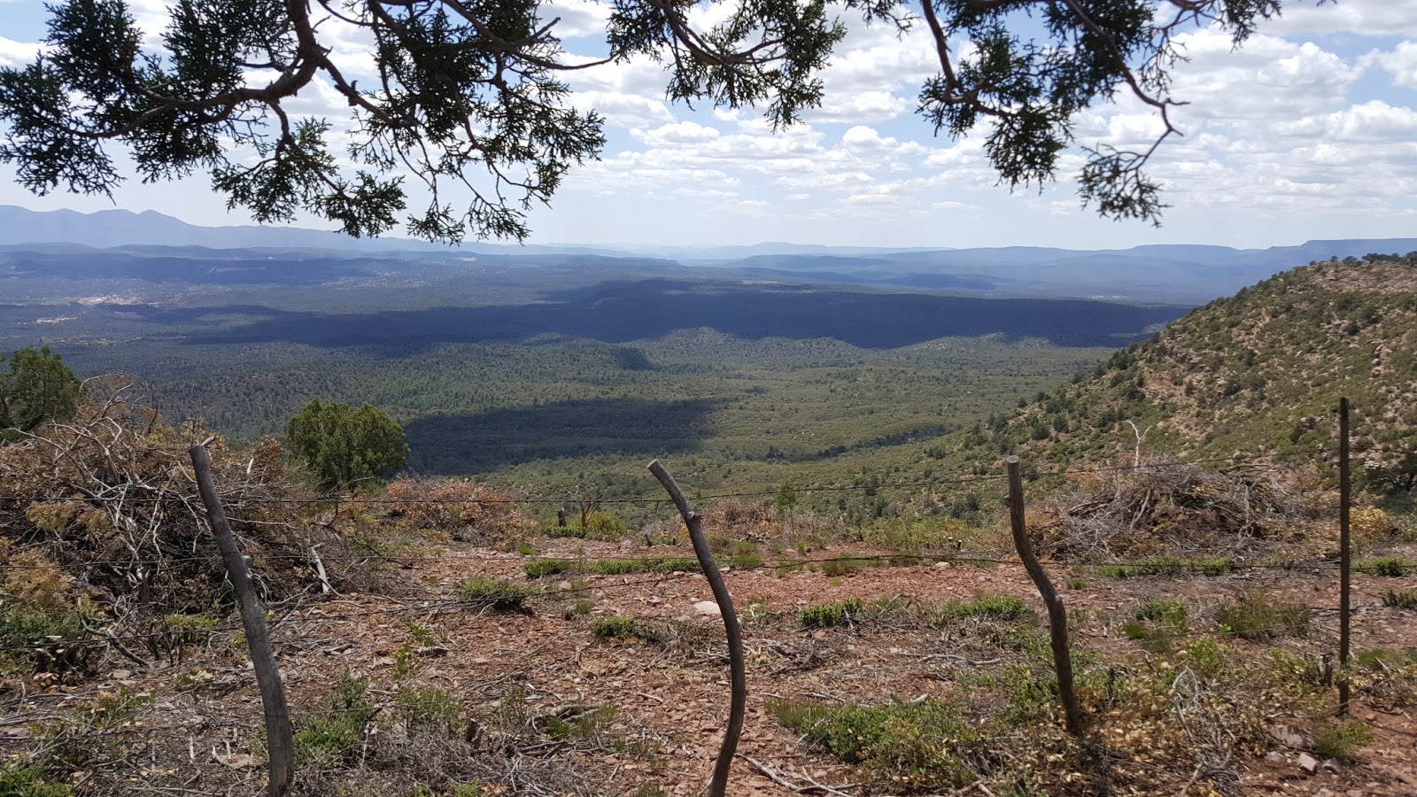 |
| One of many views from the overlook on Diamond Point Road. |
 |
| The Double D Bar and Cafe at Tonto Village. |
We all found a Mexican pizza on the menu in individual portions, so we all ordered the same thing. It came on a flat, thin, crisp tortilla, similar to a casadilla, and was topped with all the typical things found in a Mexican salad, as well as a melted cheese base. It was very good, and just the right amount for lunch.
From there, we continued back toward Diamond Point Road, but instead of turning left, we continued on down Control Road... just to explore. We stopped at a few other places along the route, where the ranger had said geodes are often found, but we didn't have much luck. Despite the spring rains and flash floods constantly turning up new stones, even the creek beds were void of any geodes. We were probably too close to the road, where other people had already picked over what may have been there.
 |
| One of many creek beds we explored along Control Road. |
 |
| Another creek bed along Control Road with the mountains of the Mogollon Rim. |
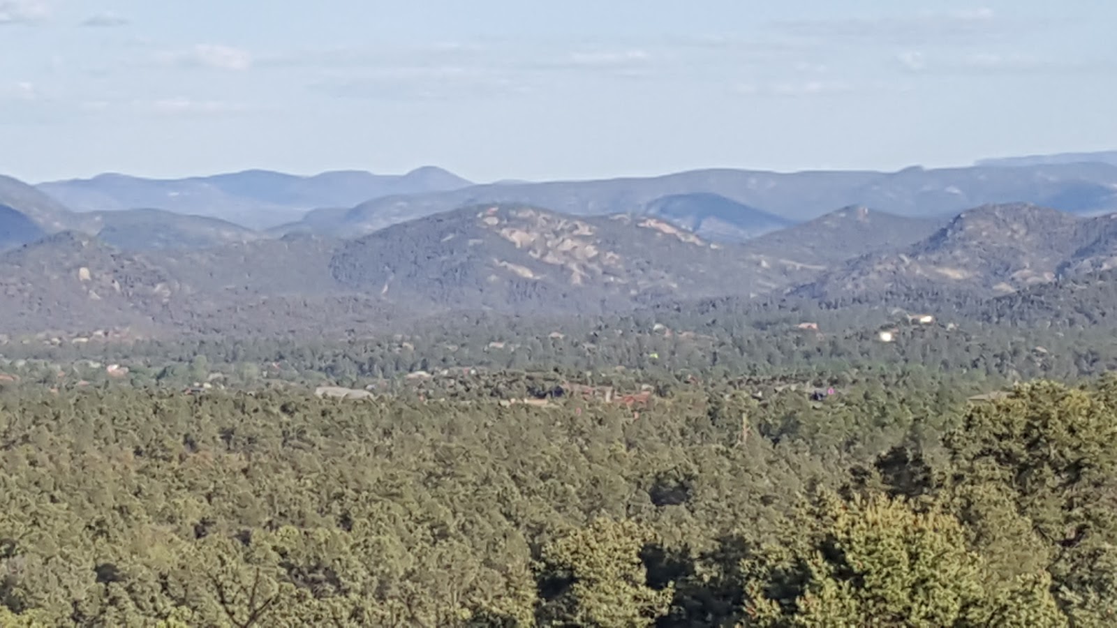 |
| Star Valley from Houston Mesa Road, near Payson. |
During the nine days we stayed with our old friend whom we have known for nearly 30 years, we shared many meals, caught up on the (roughly) ten years we have not seen her and her family, and even played a few games of cards with them. It was an enjoyable time, but we prefer to limit our stays "anywhere" to a week... maybe two at the most... depending on circumstances.
We were still waiting for our mail to be forwarded (my fault for not requesting it soon enough), and it did not arrive until the second Friday we were there. However, it was a cold, windy and rainy day... a bad day to be on the road with a motorhome. Plus, we had promised to meet with another social media "new friend" at the Mazatzal Casino for breakfast one morning, so we decided to stay until Saturday morning and then leave after that breakfast.
The meeting was with a van dweller friend of another blogger, who was also staying in the Payson area, and he had found out that we were in the area as well, and wanted to meet us, so we obliged. We had a good hour and a half visit over breakfast, and then stopped to get fuel at the nearest station and headed east on 260.
We had to face our biggest obstacle yet, as far as hills go, and that was the long, steep, 1000-foot climb up the side of the Mogollon Rim. That climb goes on for several miles before it finally tops out at a forest service overlook. However, we didn't stop to look at anything, as we were already late in getting left.
The Chevy 454 P-30 chassis labored under the long climb... down to 30 MPH and second gear at times, sometimes for a mile or more, but it performed flawlessly, with no overheating. Other than needing a new serpentine belt (or at least tightening the one we have) (it squeals sometimes when the air conditioner kicks on) the motorhome has been running well with the trailer in tow. Still, we look forward to the day when we no longer need the trailer and can get down to one vehicle, or at least something lighter to tow.
After seeing some of the forest roads and camping spots, we are seeing the need for a light 4WD vehicle to use as a scouting vehicle before we actually take the motorhome into some places. We are sure that will come about in time, but not for at least a couple of years yet. We still need the trailer until we empty out both of our rental storage units... and that may take awhile!
But before we end up with a book about this particular section of our journey, let's continue it in the next post as we work our way eastward. I also need to decide on a newer updated photo for the header, as we no longer have the van. Hopefully, I will have that before the next post is published.
Thank you all for joining us on this journey. It isn't just "a trip". This is still the beginnings of our new lifestyle, and most recently in a more suitable vehicle for our travels. We appreciate any clicks on our links whether or not you purchase anything, but purchases are always good, too!
And don't forget to take a look at Sharon's blog, also, as she often has different photos with her own perspective on things. She even has been creating some "still-shot" videos for her blog! You'll find the link in the top of the side bar. Thanks again!
No comments:
Post a Comment
We welcome conversational comments that are on topic and useful. Links to personal blogs are fine, but we will not approve comments made for the sole purpose of linking to a commercial business, and/or which have no direct relevancy to the topic of the post. Thank you.
Only those who have Google accounts may comment, as the platform has done away with the "Open ID" concept.